Find better sites, get to
LOI decisions in minutes
Dirt finds developable land in your target markets, then gives you the feasibility, zoning, and infrastructure intelligence to kill bad deals early and move fast on the winners.
Thanks! We’ll be in touch soon.
Oops! Something went wrong while submitting the form.
Partnered with leading real estate developers, builders and investors
Barron Collier Companies text logo with vertical bar design on left
Coastal Ridge logo with stylized mountain and wave graphic to the left of the text.
RESIBUILT brand logo with stylized letter R.
Meritage Homes logo with tagline Life. Built. Better.
Google Chat logo with multicolored speech bubble and text.
JM Chapman Commercial Group logo with white text on black background.
Stackpoint company logo with stylized 'S' icon on the left
Barron Collier Companies logo with vertical bar design on the left.
Stackpoint brand logo with stylized arrow above the text.
Resibuilt company logo in stylized text
Meritage Homes logo with the tagline Let It Build Better.
Logo with geometric icon followed by the word CATALYST in bold uppercase letters.
The Macallan Group logo with stylized letter M in gray and black text below.
Coastal Ridge logo with stylized ridge and wave design.
Partnered with leading real estate developers, builders and investors
Barron Collier Companies logo with vertical bars to the left of the text.
Coastal Ridge logo with gray mountain shape on the left and text on the right.
Logo of Resibuilt with a stylized letter R symbol to the left of the text.
Meritage Homes company logo.
Graphic of a folded map with location markers and the text 'LOCATION EVENT'.
JM Chapman General Contractor logo with tagline regarding construction services.
Going from raw site to moving dirt is slow and doesn't scale.
Dirt changes the game.
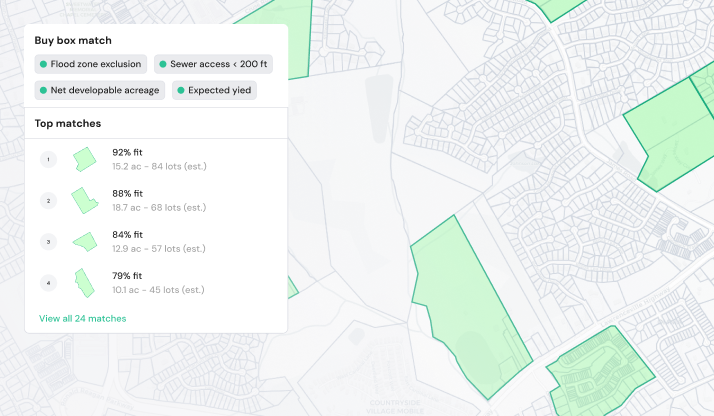
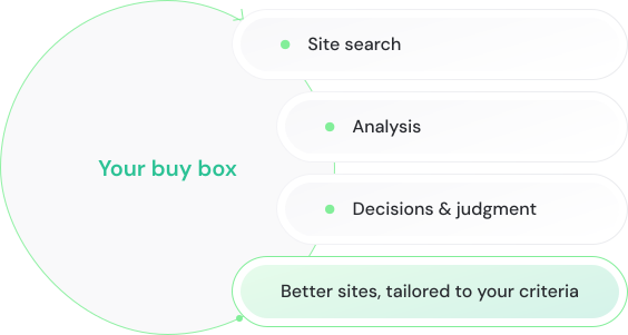
Find more sites that fit your buy box
Dirt searches your existing and new markets for parcels that match your criteria, ranked by fit.
Deals die late
Flag fatal flaws in environmental, zoning, subsurface, infra, market & entitlement risk before committing time & dollars.
Win more of the right deals
Deal volume stops being a function of headcount and consultant turnaround, so you pursue every deal that fits.
Site search is slow
Data scattered across GIS portals, zoning PDFs, flood maps, and county records, assembled by hand one parcel at a time
Deals die late
Infrastructure risks, moratoriums, zoning conflicts, and soil issues surface after the LOI — after weeks of time and soft costs are sunk
Deal volume capped
Manual work and consultant bottlenecks cap deal volume and limit expansion
Dirt compounds your edge
Dirt analyzes every parcel like a team of senior analysts, synthesizing 200+ data points at lightning speed and infinite scale.
Address, city, county, or parcel ID...
1000 Country DR Round Rock, TX
Zoning code
Future Land Use Map
Development plans
Phase 1 ESA Report
Email content
Soil and rock research
GIS Layers
Scenario model
Time saved
Risk analysis
Investment memo
Site plan
Deal score
Unified data
Feasibility summary
You are always in control. Every output is traceable, every assumption editable.
Zoning code
Future Land Use Map
Development plans
Phase 1 ESA Report
Email content
Soil and rock research
GIS Layers
Scenario model
Time saved
Risk analysis
Investment memo
Site plan
Deal score
Unified data
Feasibility summary
DIRT GIVES INSIGHTS, YOU MAKE THE CALL
You are always in control. Every output is traceable, every assumption editable.
1000 Country DR Round Rock, TX
Zoning code
Future Land Use Map
Development plans
Phase 1 ESA Report
Email content
Soil and rock research
GIS Layers
DirtAI - AI site feasibility for land developers
Scenario model
Time saved
Risk analysis
Investment memo
Site plan
Deal score
Unified data
Feasibility summary
You are always in control. Every output is traceable, every assumption editable.
Purpose-built AI for Land Development
Dirt goes deep in every market we cover, reading local zoning codes, environmental layers, rezoning history, and municipal patterns so your team gets site feasibility, rezoning insights, concept plans, and deal-ready materials without the manual work.
AI Site Feasibility
Environmental
Zoning & Entitlement
Infrastructure & Fees
Market Data
Environmental
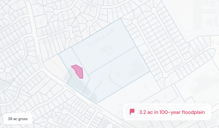
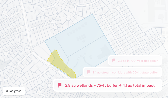
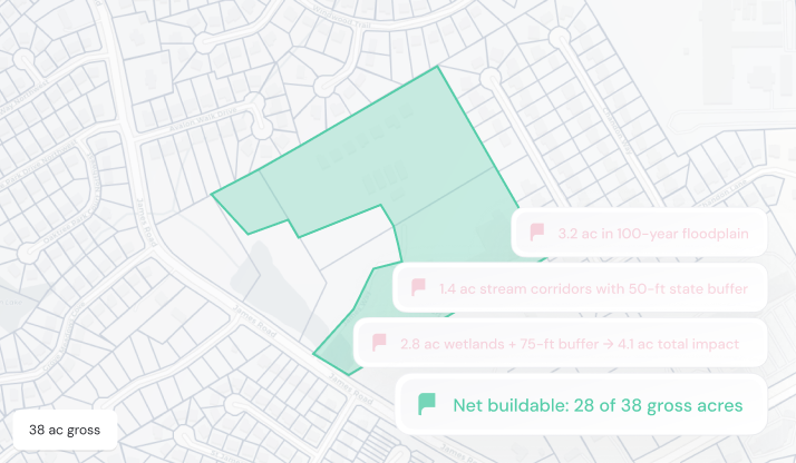
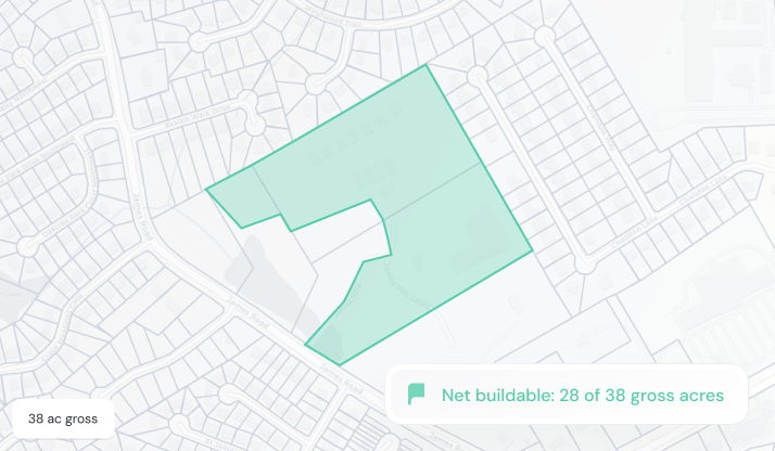
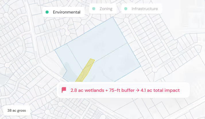
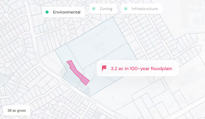
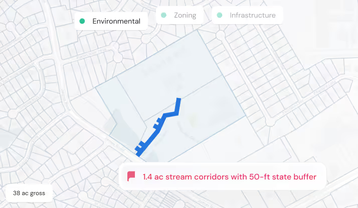
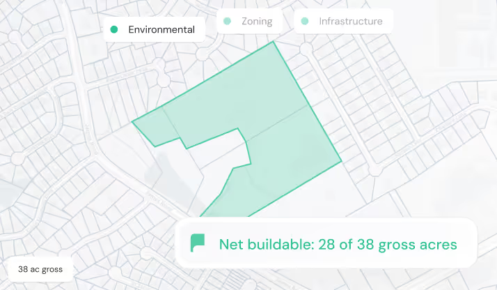
Surfaces environmental and subsurface risks, from wetlands and flood zones to contamination, soils, drainage, and bedrock, then calculates net buildable area.
Zoning & Entitlement
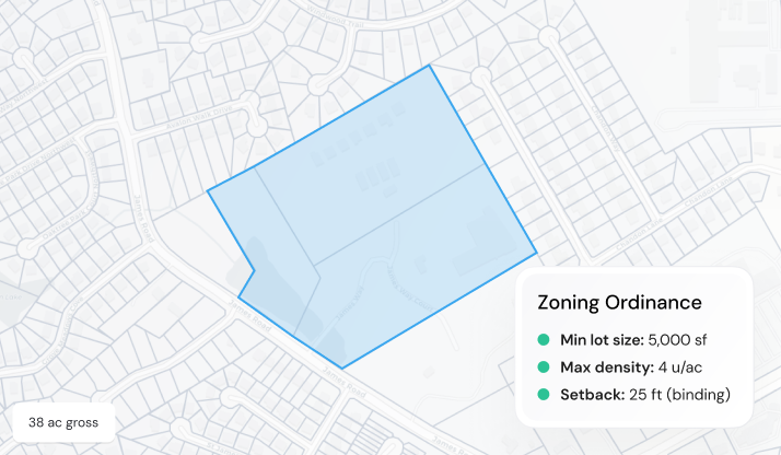
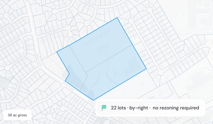
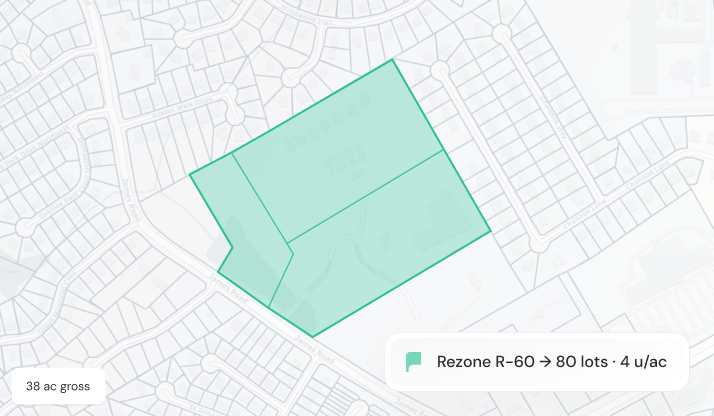
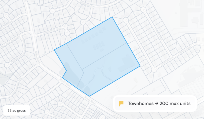
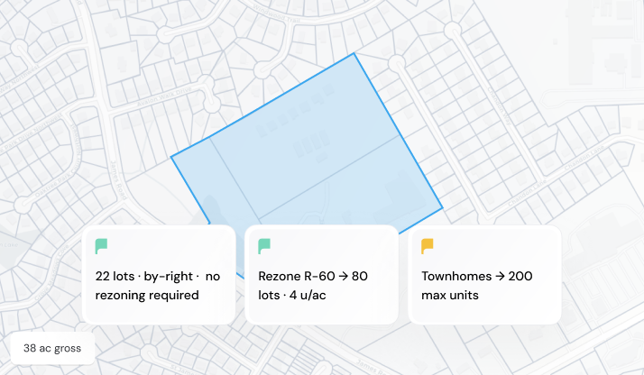
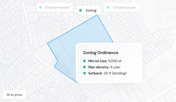
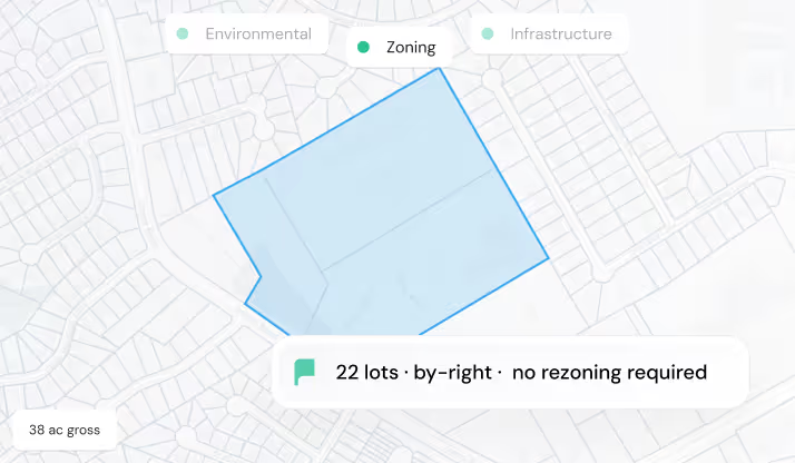
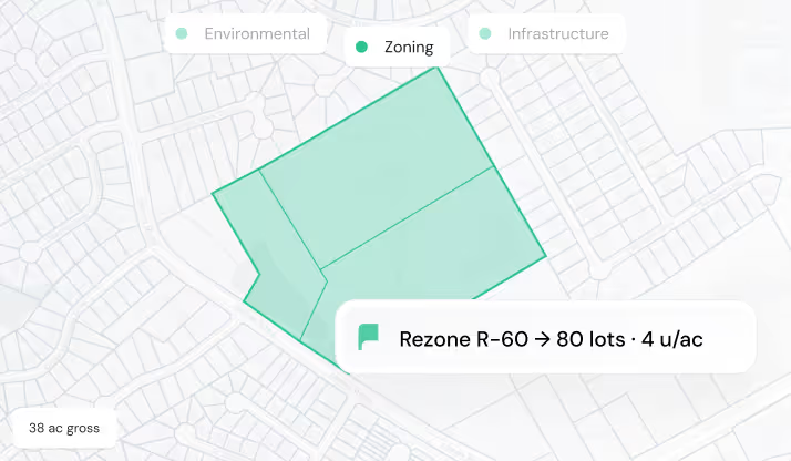
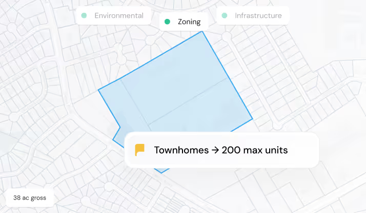
Interprets local ordinances, estimates lot and unit yield, and surfaces rezoning history, political context, entitlement activity, and competing projects.
Infrastructure & Fees
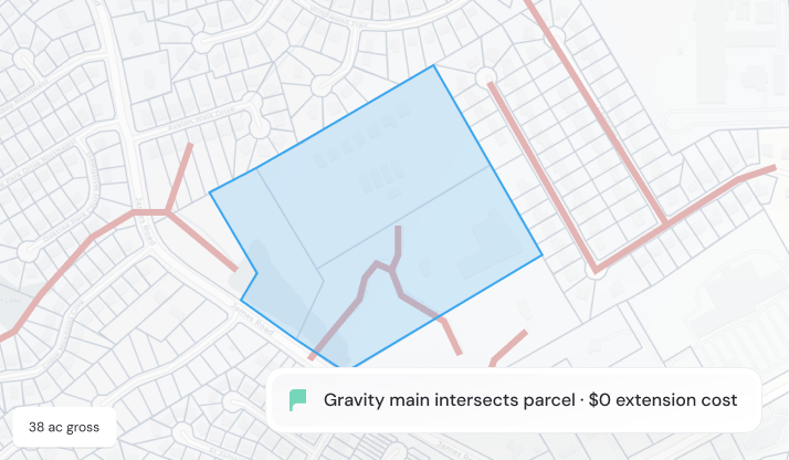
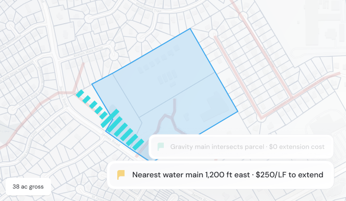
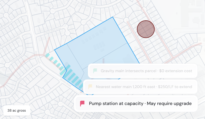
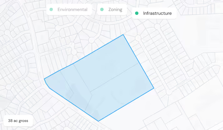
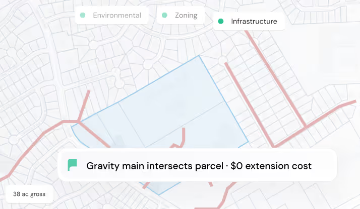
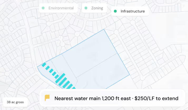
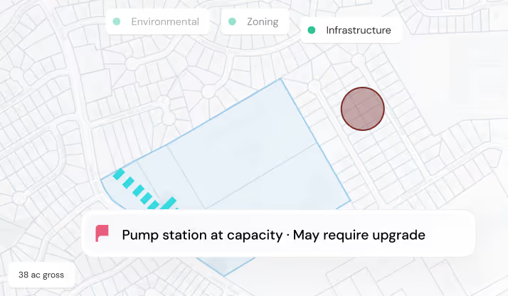
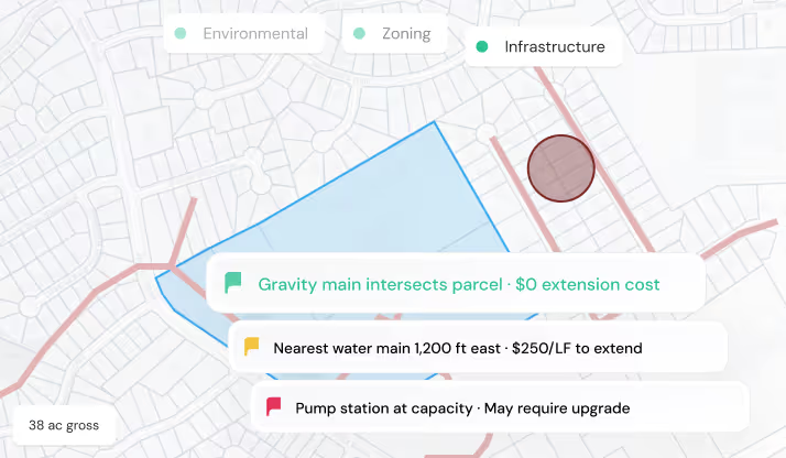
Maps water, sewer, utilities, and connection points while identifying providers and estimating jurisdiction-specific impact, permit, and tap fees.
Market Data
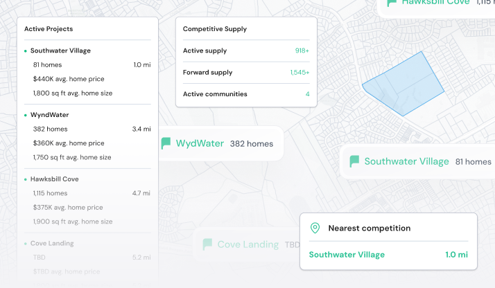
Brings together comps, supply, demographics, market trends, schools, points of interest, and the development pipeline around every site.
Map showing a 38-acre area outlined in blue with zoning rules for minimum lot size, density, and setback.Map showing a 38-acre area with 22 lots outlined in blue, indicating no rezoning required.Map highlighting a 38-acre area proposed for rezoning to R-60 with 80 lots at 4 units per acre.Map highlighting a 38-acre area zoned for townhomes with a maximum of 200 units.Map with blue outlined zone showing 22 lots no rezoning, rezone R-60 to 80 lots, max 200 townhome units.
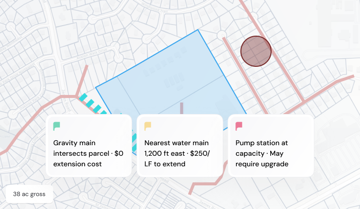
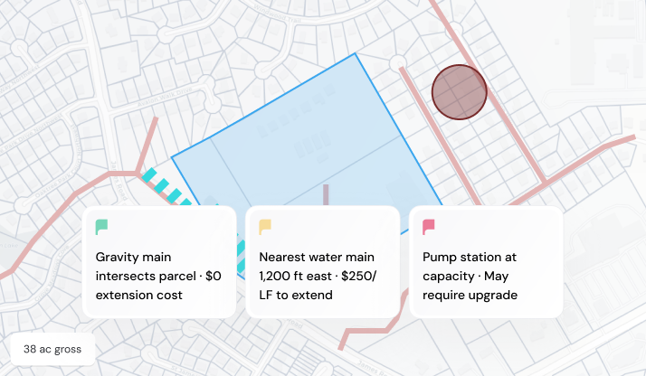
Map showing a blue-highlighted parcel intersected by Gravity main with zero extension cost noted.Map showing 38-acre parcel with water main 1,200 ft east costing $250 per linear foot to extend.Map showing a blue parcel, striped blue zone, and red circle with notes about pump station capacity and water main costs.Map showing a parcel with markers for gravity main, nearest water main, and a pump station needing upgrade.Map showing a parcel with gravity main, nearby water main 1,200 ft east, and a pump station needing upgrade.
Map showing a blue-highlighted parcel intersected by Gravity main with zero extension cost noted.
Purpose-built AI for Land Development
Dirt goes deep in every market we cover, reading local zoning codes, environmental layers, rezoning history, and municipal patterns so your team gets site feasibility, rezoning insights, concept plans, and deal-ready materials without the manual work.
AI Site Feasibility
Environmental
Identifies wetlands, flood zones, streams, and slopes, calculates net buildable area from your municipality's actual buffer requirements, and recalculates everything when you adjust an input.
Zoning
Extracts every residential zoning option from your municipality's ordinance, calculates unit yield for each, and compares rezoning scenarios side by side.
Infrastructure
Maps sewer, water, and utility access to the site — surfacing connection points, estimating off-site costs, and answering infrastructure questions directly from geospatial data.
Map highlighting a 38-acre environmental area outlined in blue within a residential and urban grid.Map showing environmental data with 2.8-acre wetlands plus 75-ft buffer totaling 4.1 acres impact.Map showing 3.2 acres in a 100-year floodplain marked in pink within a 38-acre gross area.Map showing 1.4-acre stream corridors with 50-ft buffer in blue within shaded land area labeled 38 ac gross.Map showing a highlighted environmental area with 28 of 38 gross acres net buildable.Map showing a blue outlined zoning area with a box listing minimum lot size 5,000 sf, max density 4 u/ac, setback 25 ftMap highlighting 22 lots zoned by-right with no rezoning required on a 38-acre gross area.Map highlighting a zoning area marked for rezoning from R-60 to 80 lots at 4 units per acre on 38-acre land.Map showing a blue zoning area for townhomes allowing a maximum of 200 units on 38 acres.Map highlights zoning area with 22 lots, rezoning to R-80, and townhomes up to 200 units.Map showing a 38-acre gross property outlined in blue under infrastructure category.Map showing a parcel outlined in blue with gravity main intersecting it and $0 extension cost.Map highlights infrastructure showing nearest water main 1,200 ft east with $250 per linear foot to extend.Map highlighting a pump station at capacity with note indicating it may require an upgrade.Map showing parcel outlined in blue with notes on gravity main, water main extension cost, and pump station capacity.
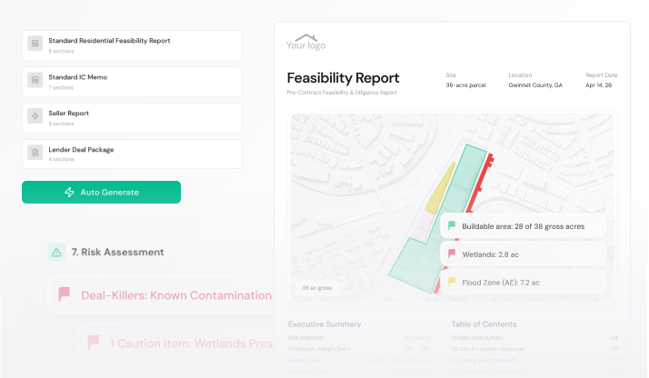
Deal Materials in One Click
Feasibility reports, IC memos, and deal summaries assembled automatically from your pipeline data.
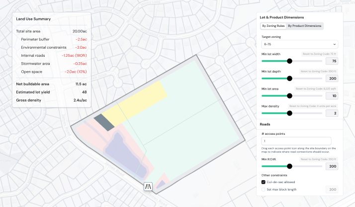
AI Concept Plans
Turn parcel constraints into a defensible concept plan in seconds, then adjust assumptions freely to test yield and support your offer.
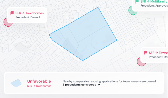
AI Municipal Insights
Assess each parcel’s political and entitlement environment using rezoning history, approvals, board votes, and nearby precedent, with cited reasoning.
What would happen to your pipeline if this were 10x faster?
Built around your buy box
Dirt learns your buy box and underwrites every deal against it, in your firm's style, across any volume and in a fraction of the time.
Finds new sites that fit your criteria
A persistent knowledge base unique to your firm
Your buy box gets smarter with every deal
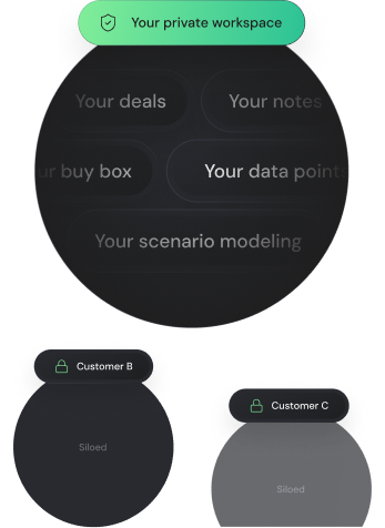
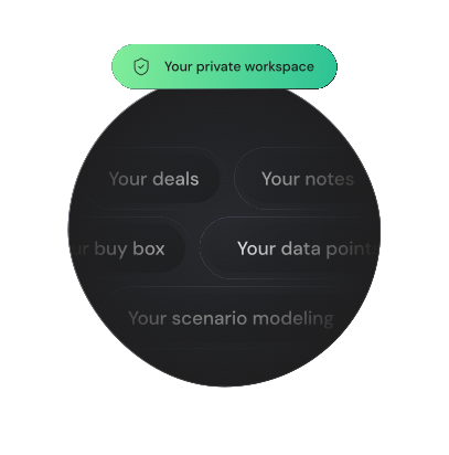
Your edge stays yours
Your deal work stays in your private workspace, and it's fully exportable whenever you want it.
No one sees your deals but you
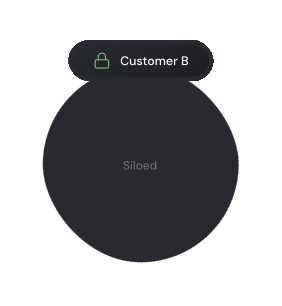
Your deals, sites, and buy box live in your firm's private workspace, isolated from every other customer's.
No model training
Your inputs, outputs, and uploaded documents are never used to train Dirt's models.
One place for your deals and data. For everyone.
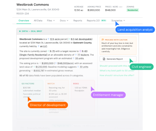
Bring your team into one workspace—with the latest numbers, files, and decisions always in view. No more stare-and-compare.
One always-current record everyone works from
Free seats for your team and outside collaborators
Comments, notes, and a clear trail of changes
No stale files or revision ping-pong across email

Ask Dirt Anything
Get fast, contextual answers in plain language. Unlike generic AI tools, Dirt is securely trained on land development data in your target markets.
Are there any moratoriums on rezoning in this municipality?
What's the undisturbed buffer requirement for streams in this county?
How many rezoning requests has this commissioner denied in the last 5 years?
What's the maximum unit yield under R-75 zoning?
Are there any moratoriums on rezoning in this municipality?
What are the system development fees per lot in this jurisdiction?
What people are saying
Smiling middle-aged man with dark hair wearing a blue collared shirt and dark jacket outdoors.
That is several weeks' worth of work right there. It blows me away.
Smiling man with short hair and beard wearing a checkered shirt against a blurry light background.
REBUILT logo in stylized uppercase letters with a geometric R icon on the left.
Dirt helps us identify feasibility issues much earlier in the process, allowing us to pass faster on low-probability deals and meaningfully reduce pursuit costs.
Man in a blue checkered blazer and white shirt smiling indoors with maps in the background.
Local Land Co. logo with Georgia state outline on the left.
Dirt allows us to confidently move from identifying an opportunity to submitting an LOI before the competition even opens the municipal code. It’s not just a time-saver; it’s a competitive advantage that profoundly changes our development process.
Smiling middle-aged man with glasses wearing a navy sweater and light blue collared shirt.
Workflows that traditionally required months of effort are now being completed in a fraction of the time. Our team is making development decisions faster and with greater confidence.
Discover what you
Frequently asked questions
What is Dirt?
Who is Dirt for?
How is Dirt different from LandGlide, LandID, or other parcel tools?
How accurate is Dirt's data?
What geographies does Dirt cover?
Does Dirt replace my land use attorney or civil engineer?
Can AI really create concept plans?
Can I export reports for my investment committee?
Is my data private? Can competitors see what I'm looking at?
If all my competitors use Dirt, doesn't that eliminate my edge?